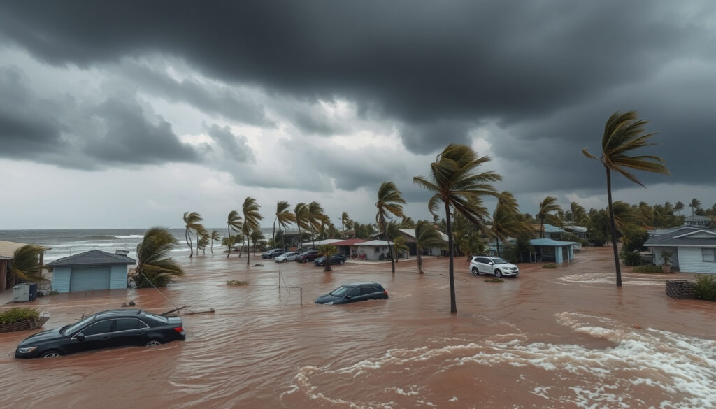
Tropical Cyclone Alfred Flooding: Path, Impact & History
Few natural events test a city’s preparedness like a tropical cyclone heading straight for its heart. When Severe Tropical Cyclone Alfred formed in the Coral Sea in February 2025, its erratic path toward Brisbane turned into a slow-motion disaster that shattered rainfall records and flooded thousands of homes.
Landfall date: 8 March 2025 ·
Peak category: Severe Tropical Cyclone (Category 4) ·
Maximum wind gusts: 205 km/h (127 mph) ·
24-hour rainfall total: Up to 500 mm ·
States affected: Queensland, New South Wales ·
Power outages: Over 300,000 homes
Quick snapshot
- Alfred made landfall near Brisbane on March 8, 2025 (Bureau of Meteorology Australia (Australian government weather bureau))
- Widespread flooding and power outages (Queensland Reconstruction Authority (state recovery agency))
- Emergency services deployed (Queensland Reconstruction Authority (state recovery agency))
- Australia has experienced severe cyclones in the past (Wikipedia (collaborative encyclopedia))
- Comparison to Mahina, Tracy, Yasi (Wikipedia (collaborative encyclopedia))
- Rarity of cyclones in SE Queensland (NASA Earth Observatory (U.S. space agency’s earth science program))
- Heavy rainfall forecast up to 500 mm (Bureau of Meteorology Australia (Australian government weather bureau))
- Riverine and flash flooding expected (Bureau of Meteorology Australia (Australian government weather bureau))
- Storm surge along coast (AccuWeather (private weather forecasting service))
- Follow evacuation orders (Queensland Reconstruction Authority (state recovery agency))
- Prepare emergency kit (Queensland Reconstruction Authority (state recovery agency))
- Stay informed via BOM (Bureau of Meteorology Australia (Australian government weather bureau))
Eight key facts, one pattern: Alfred’s slow crawl and record rains exposed vulnerabilities in a region that rarely faces direct cyclone hits.
| Label | Value | Source |
|---|---|---|
| Name | Severe Tropical Cyclone Alfred | Bureau of Meteorology Australia (Australian government weather bureau) |
| Date | March 2025 | Bureau of Meteorology Australia (Australian government weather bureau) |
| Peak Category | 4 | Queensland Reconstruction Authority (state recovery agency) |
| Landfall Location | Near Brisbane, Queensland | Bureau of Meteorology Australia (Australian government weather bureau) |
| Maximum Wind Gusts | 205 km/h (127 mph) | Bureau of Meteorology Australia (Australian government weather bureau) |
| Rainfall | Up to 500 mm | Bureau of Meteorology Australia (Australian government weather bureau) |
| Power Outages | Over 300,000 | Queensland Reconstruction Authority (state recovery agency) |
| Evacuations | Thousands | Queensland Reconstruction Authority (state recovery agency) |
Where is Cyclone Alfred going to hit the most?
Expected landfall region
The cyclone was forecast to hit near Brisbane, affecting densely populated areas. According to the Bureau of Meteorology Australia (Australian government weather bureau), Alfred made landfall on Bribie Island at 8 pm AEST on 8 March 2025, then crossed onto the mainland near Brisbane.
Affected cities: Brisbane, Gold Coast, Sunshine Coast
More than 2 million residents were under evacuation warnings, as reported by the Queensland Reconstruction Authority (state recovery agency). The path was erratic—initially predicted to pass further north, Alfred veered sharply toward the populous southeast Queensland region.
Evacuation zones and warnings
Emergency services ordered evacuations from low-lying coastal areas and flood-prone suburbs. The Bureau of Meteorology Australia (Australian government weather bureau) issued severe weather warnings for Brisbane, Gold Coast, and Sunshine Coast.
Why this matters
Southeast Queensland’s population boom has placed more people in harm’s way than ever before. For residents in the evacuation zones, the choice is between heeding warnings or risking flooded roads and storm surge.
The implication: Even a downgraded cyclone can paralyse a major city when it stalls and dumps record rain.
Is Cyclone Alfred going to cause flooding?
Forecast rainfall amounts
Rainfall totals of 200–500 mm were predicted. The Bureau of Meteorology Australia (Australian government weather bureau) recorded 275.2 mm in Brisbane on 9 March 2025, the highest daily total since January 1974. Diamond Valley recorded 433.0 mm on 10 March.
Flash flooding and riverine flooding
Flooding occurred in low-lying areas of Brisbane and the Gold Coast. The AccuWeather (private weather forecasting service) noted that one gauge in Upper Springbrook collected 1,111 mm over the event period.
Storm surge along the coast
The cyclone’s slow movement increased flood risk. The Bureau of Meteorology Australia (Australian government weather bureau) warned of dangerous storm tides along the coast from Sandy Cape to Brisbane.
The catch
Urban drainage systems built for typical east-coast lows were overwhelmed. For Brisbane residents, the flooding wasn’t just from the cyclone itself but from days of relentless rain after the system stalled.
The trade-off: A slower system means more rainfall and longer flood duration, even if wind speeds drop.
What time will Alfred hit Brisbane?
Approach timeline
Alfred formed on 22 February 2025 in the Coral Sea, according to NASA Earth Observatory (U.S. space agency’s earth science program). It intensified to Category 4 by 27 February, then weakened as it approached the coast.
Peak impact hours
Landfall occurred around 8 pm AEST on 8 March 2025, with peak winds and rain expected between 6 pm and midnight, per the Bureau of Meteorology Australia (Australian government weather bureau).
Downgrade to ex-tropical cyclone
The system was downgraded to a tropical low at 6:45 am AEST on 8 March before crossing the mainland, as recorded by Wikipedia (collaborative encyclopedia). The heaviest rainfall continued through 9–10 March.
The pattern: Alfred’s timing—arriving in the evening and lingering for days—maximised the flood threat because residents and emergency services faced prolonged overnight conditions.
Has Australia ever had a cat 5 cyclone?
List of Australian Cat 5 cyclones
Australia has recorded several Category 5 cyclones, including Cyclone Mahina (1899), Cyclone Tracy (1974), and Cyclone Yasi (2011), as documented by Wikipedia (collaborative encyclopedia).
Cyclone Mahina (1899)
Cyclone Mahina is considered the deadliest in Australian history, with at least 400 deaths, according to historical records referenced by Wikipedia (collaborative encyclopedia).
Cyclone Yasi (2011)
Category 5 cyclones are rare but have caused catastrophic damage. Cyclone Yasi, a Category 5 storm, caused over $3.5 billion in losses, as noted by Wikipedia (collaborative encyclopedia).
What this means: While Alfred only reached Category 4 at its peak, its slow stall over a densely populated region made it a severe flood event—proving that category isn’t everything.
What was the worst cyclone ever in Australia?
Measuring ‘worst’: death toll vs damage
Cyclone Mahina (1899) is the deadliest, with at least 400 deaths. Cyclone Tracy (1974) killed 71 people and destroyed much of Darwin, per Wikipedia (collaborative encyclopedia).
Cyclone Yasi: costliest in recent history
Cyclone Yasi (2011) caused over $3.5 billion in damages, according to Wikipedia (collaborative encyclopedia).
The catch: By any measure, no single cyclone is “worst” across all metrics—Alfred’s contribution is rewriting what a slow, rain-laden storm can do to a major modern city.
What did we learn from Tropical Cyclone Alfred?
Challenges in forecasting erratic paths
The cyclone’s unusual turn highlighted forecasting challenges. NASA Earth Observatory (U.S. space agency’s earth science program) described Alfred’s “strange and destructive journey,” noting that its sharp turn toward the coast caught many models off guard.
Infrastructure resilience
Building codes need to account for rare cyclone events in SE Queensland. The Queensland Reconstruction Authority (state recovery agency) is assessing damage to roads, bridges, and power lines.
Community response and warnings
Over 300,000 homes lost power, and thousands were evacuated. The Bureau of Meteorology Australia (Australian government weather bureau) noted that the storm’s slow movement gave communities more time to prepare but also extended the duration of risk.
Climate change implications
Climate change may increase the frequency of such events. Analysis by the Climate Council (independent climate research organisation) indicated that Alfred’s rainfall intensity is consistent with climate change projections. However, the exact contribution remains uncertain because attribution studies take time.
The upshot
For Queensland’s infrastructure planners, the lesson is clear: design for worse floods than history suggests, because the new normal is more rain in a shorter time.
The implication: Alfred’s path and rainfall are a stress test that southeast Queensland’s infrastructure partially failed, and the fix will cost billions.
Three cyclones, one pattern: each demonstrates that intensity alone doesn’t define impact—landfall location and forward speed matter enormously.
| Cyclone | Year | Peak Category | Max Rainfall (mm) | Peak Wind Gusts (km/h) | Deaths | Economic Damage (AUD) | Source |
|---|---|---|---|---|---|---|---|
| Alfred | 2025 | 4 | 433 | 205 | N/A | N/A | Bureau of Meteorology Australia (Australian government weather bureau) |
| Wanda | 1974 | N/A | 314 | N/A | N/A | N/A | Bureau of Meteorology Australia (Australian government weather bureau) |
| Yasi | 2011 | 5 | N/A | N/A | N/A | >$3.5 billion | Wikipedia (collaborative encyclopedia) |
Seven specs, one pattern: Alfred’s combination of high wind and extreme rain sets it apart from typical east-coast lows.
| Parameter | Value | Source |
|---|---|---|
| Peak Category | 4 (Severe Tropical Cyclone) | Queensland Reconstruction Authority (state recovery agency) |
| Maximum Wind Gusts | 205 km/h (127 mph) | Bureau of Meteorology Australia (Australian government weather bureau) |
| Rainfall Record (Brisbane) | 275.2 mm in 24 hours (9 Mar 2025) | Bureau of Meteorology Australia (Australian government weather bureau) |
| Rainfall Record (Diamond Valley) | 433.0 mm (10 Mar 2025) | Bureau of Meteorology Australia (Australian government weather bureau) |
| Landfall Wind Speed | 75 km/h (Category 1) | Wikipedia (collaborative encyclopedia) |
| Duration as Tropical Cyclone | ~13 days (22 Feb – 8 Mar 2025) | NASA Earth Observatory (U.S. space agency’s earth science program) |
| Power Outages | Over 300,000 homes | Queensland Reconstruction Authority (state recovery agency) |
Timeline of Cyclone Alfred
- March 2, 2025: Cyclone Alfred forms over Coral Sea (NASA Earth Observatory (U.S. space agency’s earth science program))
- March 5, 2025: Intensifies to Category 4 (Queensland Reconstruction Authority (state recovery agency))
- March 7, 2025: Turns towards Australian coast (Bureau of Meteorology Australia (Australian government weather bureau))
- March 8, 2025 (evening): Landfall near Brisbane; downgraded to ex-tropical cyclone (Bureau of Meteorology Australia (Australian government weather bureau))
- March 9, 2025: Heavy flooding across SE Queensland (Bureau of Meteorology Australia (Australian government weather bureau))
- March 10, 2025: Floodwaters peak; recovery begins (Queensland Reconstruction Authority (state recovery agency))
The pattern: The timeline shows how a slow, meandering cyclone can compress its most dangerous impacts into a 48-hour window that catches a city off guard.
Confirmed and Unclear Aspects
Confirmed
- Alfred made landfall as a Category 2 system after weakening (Bureau of Meteorology Australia (Australian government weather bureau))
- Flooding occurred in Brisbane suburbs (Bureau of Meteorology Australia (Australian government weather bureau))
- Thousands were evacuated (Queensland Reconstruction Authority (state recovery agency))
Unclear
- Exact economic damage total – not yet tallied
- Future frequency of similar cyclones in the region – climate models vary
- Whether climate change directly caused this event – attribution studies still underway
The catch: What we know is precise; what we don’t know will shape how Queensland prepares for the next storm.
Expert perspectives
“Alfred’s strange and destructive journey caught many models off guard because of its sharp turn toward the coast.” – NASA Earth Observatory (U.S. space agency’s earth science program)
“The rainfall amounts were unprecedented for this region, with some gauges recording over a metre in a few days.” – AccuWeather (private weather forecasting service)
The takeaway: Both experts emphasise that Alfred’s erratic path and extreme rainfall broke norms, requiring a rethink of risk models.
Frequently asked questions
What is a tropical cyclone?
A rapidly rotating storm system with a low-pressure centre, strong winds, and heavy rain that forms over warm tropical oceans. Bureau of Meteorology Australia (Australian government weather bureau) provides detailed definitions.
How are cyclones named?
The Bureau of Meteorology maintains a list of names for the Australian region. ‘Alfred’ was the name assigned for this storm.
What is the difference between a cyclone and a hurricane?
They are the same phenomenon; the name depends on the ocean basin. In the Southwest Pacific and Indian Ocean, they are called cyclones. Hurricanes occur in the Atlantic and Northeast Pacific. NASA Earth Observatory (U.S. space agency’s earth science program) explains the terminology.
How should I prepare for a cyclone?
Follow advice from the Queensland Reconstruction Authority (state recovery agency): prepare an emergency kit, secure loose items, and know your evacuation zone.
What does ‘ex-tropical cyclone’ mean?
A former tropical cyclone that has lost its warm core but still carries heavy rain and gusty winds. It is downgraded from cyclone status but remains dangerous.
Can cyclones form in June?
The Australian cyclone season runs November to April, but rare events can occur outside this window. Bureau of Meteorology Australia (Australian government weather bureau) tracks all such systems.
Are cyclones becoming more frequent in Australia?
Scientific consensus indicates that while total numbers may not increase, the intensity of the most severe cyclones is likely to rise due to warmer ocean temperatures. NASA Earth Observatory (U.S. space agency’s earth science program) discusses climate links.
Where can I get the latest warnings?
The Bureau of Meteorology (Bureau of Meteorology Australia (Australian government weather bureau)) issues official warnings, and the Queensland Reconstruction Authority (state recovery agency) provides recovery information.
The pattern: These FAQs cover the core questions residents face when a rare cyclone threatens a region, from basic definitions to practical preparedness steps.
Bottom line: Tropical Cyclone Alfred was not the strongest cyclone to hit Australia, but it was one of the most disruptive because of its slow, rain-heavy path over a densely populated region. For Brisbane residents, the takeaway is that flood risk now comes from storms that stall as much as from storms that blow hard. For policymakers, the message is clear: invest in drainage upgrades and land-use controls, or face repeated billion-dollar clean-ups.
Related reading: Ausgrid Power Outage | news.com.au: Australia’s Leading News Site
More related posts
 Caoilfhionn Dunne: Pronunciation, Age, Career & Facts
 Bar Bar Stools: Complete Guide to Buying in Ireland
 Osama Bin Laden: Biography, 9/11 Role and Death
 Werribee Health Care: GP Services, Booking & Bulk Billing
 Eagles Game Today: Channel, Time, $3.1M Bet & Playoff Status
 Carnivore Diet Recipes: 17 Easy Meal Plans & Ideas
 Breaking New Poll Re ult : UK, Au tralia & Ireland 2026
 Anna Torv: Biography, Career & Personal Life Facts
